Tuesday Feb 24, 2026
Tuesday Feb 24, 2026
Saturday, 27 June 2015 00:00 - - {{hitsCtrl.values.hits}}
By D.C. Ranatunga
The popularity of Galle as a tourist destination was most evident during the recent Sri Lanka-Pakistan Test Match played there.
During the TV coverage of the match so many European tourists in casual wear were seen mingling with the locals. For some, the ramparts provided an excellent place to watch the game in a relaxed mood. Many were posing for photographs with a panoramic view of the sea in the background.
Galle has not lost its charm
Galle has not lost its charm from the days of the Portuguese and the Dutch dating back to the 16th-17th centuries. Recognising the historical value of Galle and its fortifications, UNESCO declared Galle as one of the World Heritage Sites in Sri Lanka.
“An outstanding example of an urban ensemble which illustrates the interaction of European architecture and South Asian traditions from the 16th to the 19th centuries,” is how UNESCO describes Galle. The use of European models adapted by local manpower to the geological, climatic, historical, and cultural conditions of Sri Lanka has been identified as the most salient feature by UNESCO.
Reference is made to the bay of Galle off the south-west coast of Sri Lanka, sheltered by a rocky peninsula, as early as 545 in the cosmography of Cosmas Indicopleustes, the sixth century traveller who made several trips to India as an Alexandrian merchant. It has been identified as one of the most ancient ‘ports of call of the Levant’ (the word used to identify an area in the eastern Mediterranean).
When Chinese traveller Ibn Batuta landed in 1344, he found Galle to be the principal port of Sri Lanka. He says he journeyed from Dondra to Galle and that he was treated by a Muslim named captain Ibrahim in Galle who had a residence in the town. 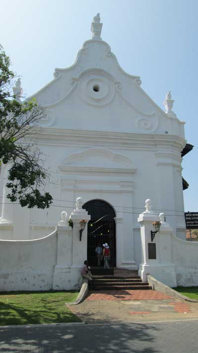
Well-established commercial centre
Professor W.I. Siriweera states that the Chinese junks that came through the Straits of Malacca touched at Galle. The trilingual inscription found in Galle dating back to the 15th century has been written in Chinese, Persian and Tamil indicating that Chinese, Muslim and South Indian and Jain traders frequented the port.
The fact that Sinhala sandesa poems have mentioned Galle is proof that it had been a well-established commercial centre by the 15th century, he writes in ‘Heritage of Sri Lanka’. He adds that it was a town with wide streets beside which were located local shops.
As for the name, Ibn Batuta refers to Galle as ‘quali’. A possible derivation is the Sinhala word ‘gaala’ meaning resting place where carters broke journey at night to give the bulls and themselves a rest while transporting goods from one place to another. Another theory is that the word Galle is derived from the Dutch word ‘gallus’ which means fowl. The Dutch have also used it as a symbol of
Galle.Galle Fort
After gaining control of the maritime area, the Portuguese found resistance from the king in Sitavaka and to fortify themselves they built a fort in Galle. They hurriedly constructed a rampart and three bastions. A Franciscan chapel was built in 1543.
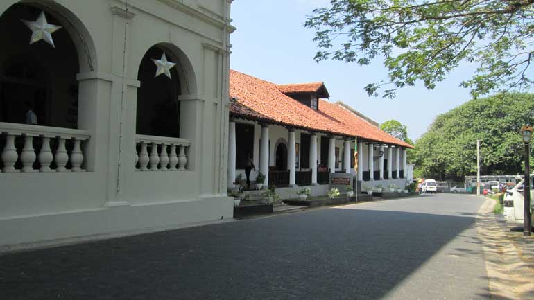
Galle has become famous for the fortified city built by the Dutch after they took over the city from the Portuguese in 1640. They built a fortified wall, using solid granite, and built three main bastions, known as ‘Sun’, ‘Moon’ and ‘Star’ replacing the precarious Portuguese defences constituted partially of palisades and earth banks. They encircled the whole of the peninsula with a bastioned stone wall so as to render it impregnable against the English, French, Danish, Spanish and Portuguese fleets vying with Holland for the supremacy of the sea.
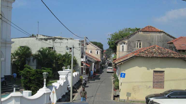
The fort had an area of 52 ha inside the walls defended by 14 bastions. UNESCO records that the majority of the curtain walls were built in 1663, and the northern fortified gate was protected by a drawbridge and a ditch in 1669. Much of the city, laid out on a regular grid pattern adapted to the configuration of the terrain (north-south peripheral streets are parallel to the ramparts and not to the central traffic axes), dates from this period.
18th century Galle
During the 18th century, protected by a sea wall finished in 1729, the city reached full development. It housed 500 families, and a large number of public administrations, trade establishments and warehouses were located there. A Protestant, Baroque-style church, the oldest in Sri Lanka, was constructed in 1775 for the European colonists and a few Christian converts from plans drawn up by Abraham Anthonisz.
However, Galle remained essentially a stronghold. In the layout of the city the Commandant’s residence, the arsenal and the powder house were prominent features. The forge, carpentry and rope-making workshops, the naval guardhouse, and barracks rounded out a system that closely linked prosperous trade to military security.
The wide streets, planted with grass and shaded by suriya trees, were lined with houses, each with its own garden and an open veranda supported by columns, another sign of the acculturation of an architecture which is European only in its basic design.
Surrender
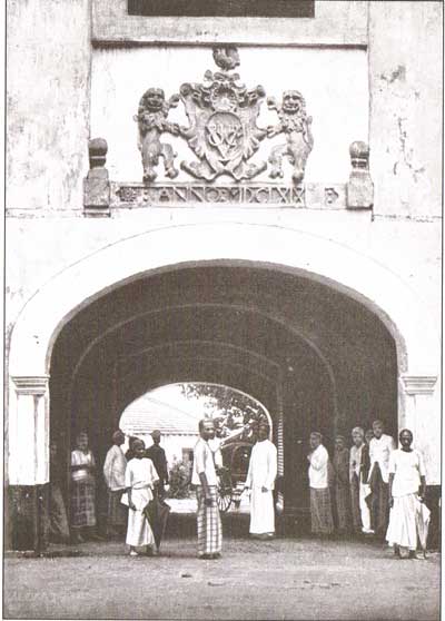
The fort of Galle was handed over by the Dutch to the English East India Company on 23 February 1796, one week after the surrender of Colombo. As a British protectorate, Galle remained the administrative centre of the south of Ceylon.
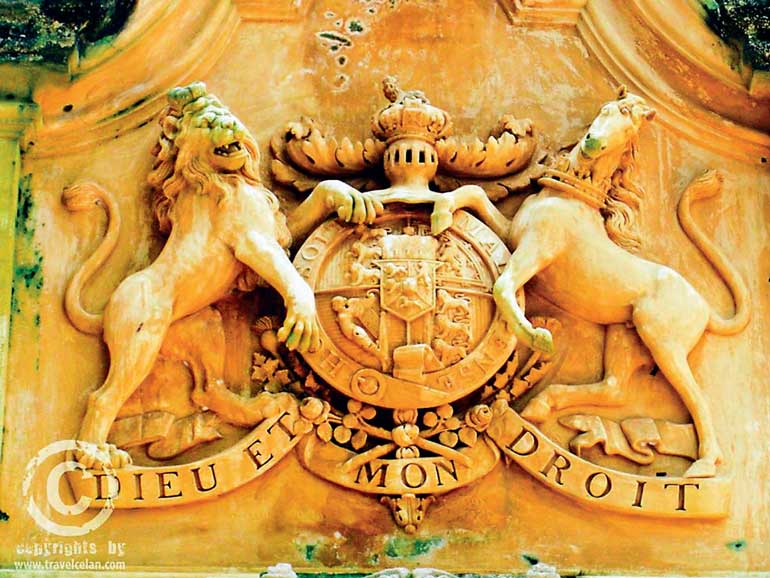
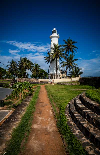
The UNESCO report refers to “a number of unfortunate modifications” with ditches being filled in, new blockhouses added, a gate put in between the Moon bastion and the Sun bastion, a lighthouse installed on the Utrecht bastion, and a tower erected for the jubilee of Queen Victoria in 1883.
Galle remains the best example of a fortified city built by Europeans in South and South-East Asia. It also shows the interaction between European architectural styles and South Asian traditions.
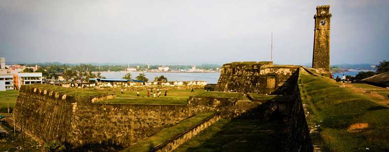
The fort of Galle is unique among the fortresses erected by the Dutch in their colonies in Asia. It was planned as a walled-in town in the 17th century and continues to function as a living suburb at present. Its classical layout as a fort remains basically unaltered.
Modelled and built specifically as the Company’s southern headquarters, the fortress at Galle was a splendid example of defence against artillery and ranked second only to Colombo in importance and size.
Galle functioned as the military centre of a command line of stockades and fortresses that the Dutch developed to protect their lucrative trade. The Galle Commandment (as the administrative district was referred to during Dutch rule) was the heart of the cinnamon and elephant trade and produced a sizeable part of the Company’s revenue.
Though Colombo was an administrative and civic capital during the first four centuries of European colonial rule, Galle was considered the premier port-city. It was only in the late 19th century that Galle’s importance as a harbour declined, as plans were already afoot by the 1860s to improve Colombo’s port facilities.
The essential feature that helped Galle to earn its fame as one of the safest maritime ports was its inner harbour, which was formed by a natural reef-spur. This natural marine projection protected sailing crafts and ships from the strong seasonal monsoonal winds, currents and sudden squalls, which were unpredictable and hazardous in the coastal bays of the Indian Ocean. Galle harbour nevertheless has its share of shipwrecks.
– From ‘The Images of British Ceylon’ by Ismeth Rahim & Percy Colin Thome

